Recording and Inputting Speed Data
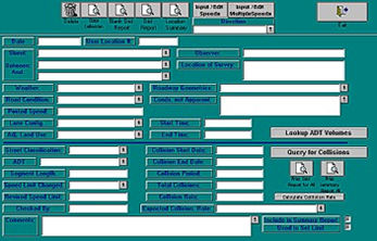
The Speed Survey Location form (shown at the top left) is used for inputting
speed data for individual survey locations. Of course, at least one speed
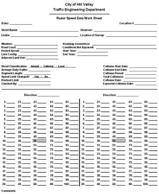
survey must be done first before data can be inputted into the system. Users
can print blank radar survey sheets (blank grid reports or blank data collection
reports) to take into the field and record survey information.
Once a speed survey has been taken, the data can then be entered into the Speed Survey Analysis System using the Location form. The form has fields for location information, weather and road conditions, speed limit information, collision data, comments, conditions not apparent, and more.
When used in conjunction with the Traffic Collision Database, the Speed Survey System can look up and calculate average daily traffic (ADT) volumes and collision rates.
Ease of Use
Inputting survey location data is incredibly easy because the Location form
uses drop-down menus in many of its fields. These menus contain pre-configured
lists of data and employ the "auto-match" feature, which fills out
potential matches as you type.
Users advance from field to field by simply hitting the <Tab> key, although some fields, known as "fixed length" fields, automatically advance the cursor when the maximum number of spaces has been reached.

