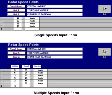
Single and Multiple Speeds
Depending on how speed data was collected, speeds can be inputted into the
system either individually or in multiples. After specifying the location
and direction, the user then enters the speeds in a very simple, understandable
input form (shown at the top left). If speeds were recorded individually (e.g.,
35mph, 30, 43, 35, 40, 32, etc.), they can be inputted into the system the
same way. If they were recorded in multiples (e.g., 3 at 35mph, 2 at 45, 1
at 48, etc.), they can be inputted using the multiple speeds form.
Additional survey location information can be entered before or after inputting the speed data. Each location record can hold weather, lane configuration, street classification, segment length, speed limit, and collision information. All of this data is used by the system when producing analytical reports for individual locations or for all locations in the database (see the next section for more on reports).
Editing Speed and Location Data
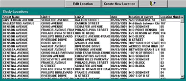
Existing survey location records and speed data can be edited and deleted
by the user. The Study Locations screen (see image at bottom left) provides
a list of all existing survey location records. Selecting a specific record
brings it up in the survey location form with all data placed in their appropriate
fields. Existing data can be edited or deleted, new data can be added, and
the speeds can be edited as single or as multiple speeds. The complete record
itself can be removed entirely from the database if necessary.